

In Baneswell, at the crossroads of East Street, Blewitt Street, Baneswell Road, and Caxton Place, sits an old stone wall that feels entirely out of place. With the road sitting noticeably higher than the cottage pavement below, it now serves as a retaining wall—but while it still performs that duty today, was that its original purpose?
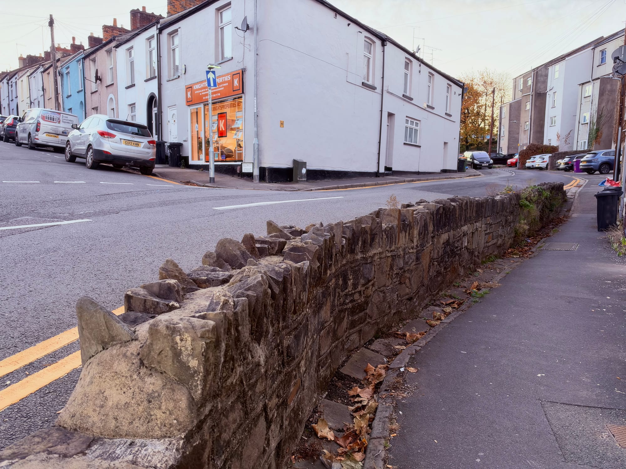
Built from rough-coursed Pennant sandstone with upright 'cock-and-hen' coping stones, the masonry carries the hallmarks of an early nineteenth-century rural revetment rather than standard Victorian town infrastructure.
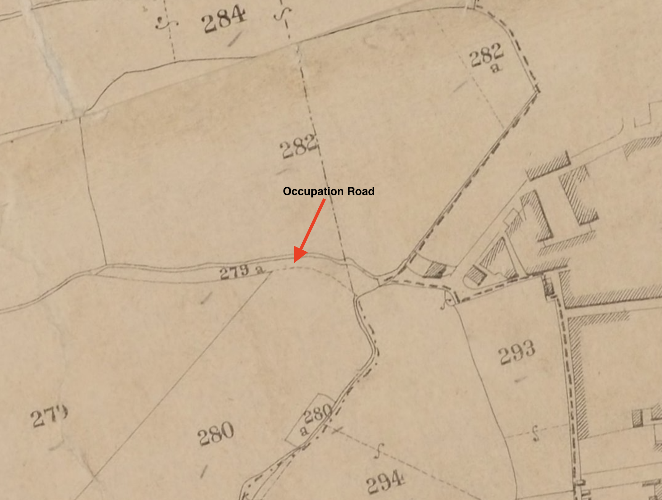
Consult the tithe map of the early 1840s and Baneswell looks unrecognisable. The town did not extend beyond where the Queen's Buildings stand today, and apart from a solitary track along the line of North Street, the surrounding grid of residential streets did not yet exist. Instead, opening out from the crossroads lay the entrance to an 'occupation road'—a private agricultural track designated to access enclosed fields, meadows, and private grounds.
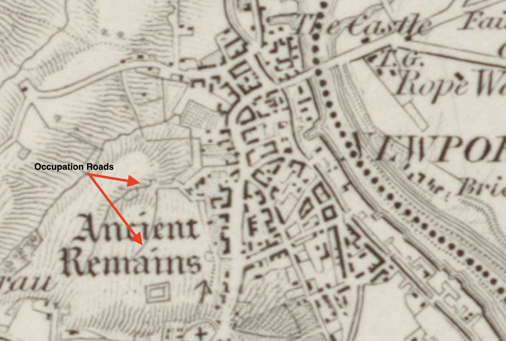
Newport once had several such occupation roads. One was located along Brynglas Road between All Saints Church and Brynglas Avenue (which allowed Crindau House access north towards Brynglas House and Pillmawr Road), another along Spring Street and the steps towards Ailesbury Street, and another was a lane running along part of Cromwell Road.
This particular track served the agricultural estate of Glasllwch House. With the main house situated some distance away on Risca Road, the track highlights just how far the family's landholdings extended into what was then open country. The lane curved gently past fields 283 and 279 on the tithe survey, skirting near field 241 around the present head of Tunnel Terrace. Rather than serving a dwelling, it existed purely to reach pasture parcel 278 at the top of the hill.
There was potentially another occupation road branching off from the same cross roads leading up Blewitt Street and eventually ending up at the house of Lewis Edwards at the bottom of York Place. He could be the same Lewis Edwards who served on the council in the 1830s and was mayor in 1842-43. There are no remnants of this road remaining.
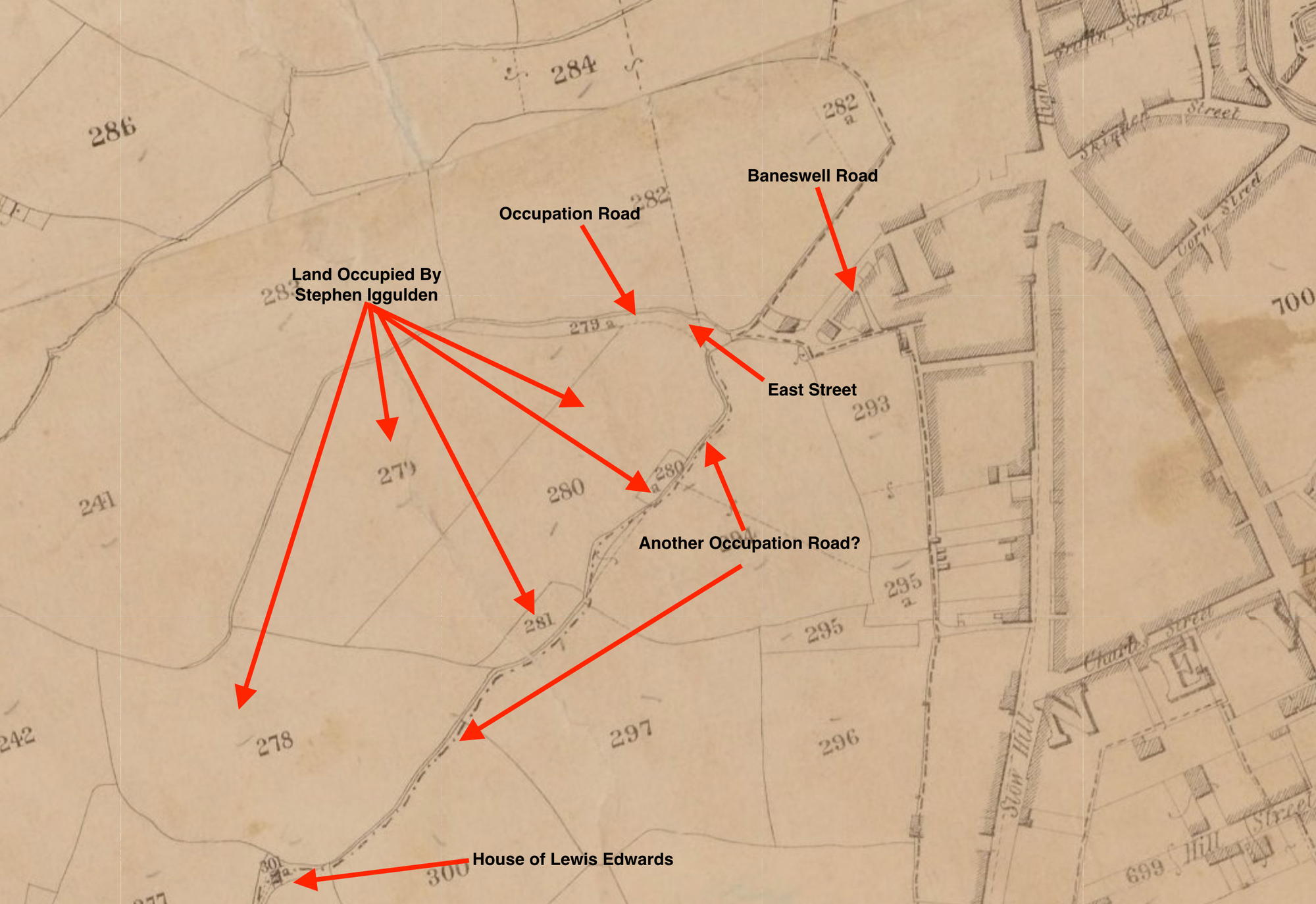
The land was owned by the late Edward Blewitt who's surname was probably used for the street adjoining the occupation road. The Blewitt family was a prominent landowning and political family in the Newport and Monmouthshire area, with historical connections to Llantarnam Abbey and local industry.
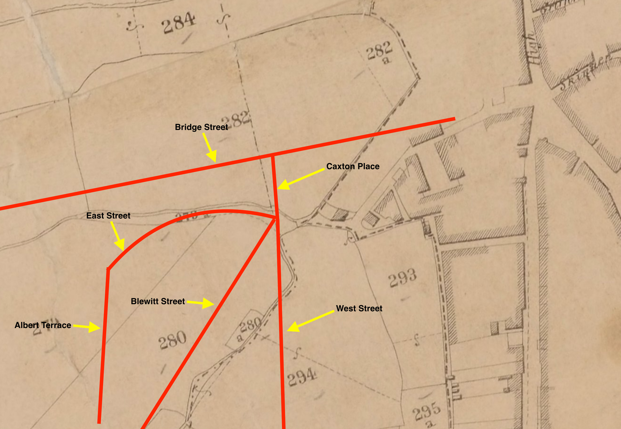
The land itself—including the occupation road—was occupied by Stephen Iggulden (d.1856), a notable figure in nineteenth-century Newport municipal life. Perhaps best known locally as the proprietor of both the Carpenter's Arms and the Sailors' Return on Market Street, Iggulden served on the town council through the 1830s alongside prominent civic figures such as Daniel Toombs, Richard Mullock (mayor 1842-43), and Joseph Latch (mayor 1845-46), eventually rising to become Mayor of Newport in 1852–53.
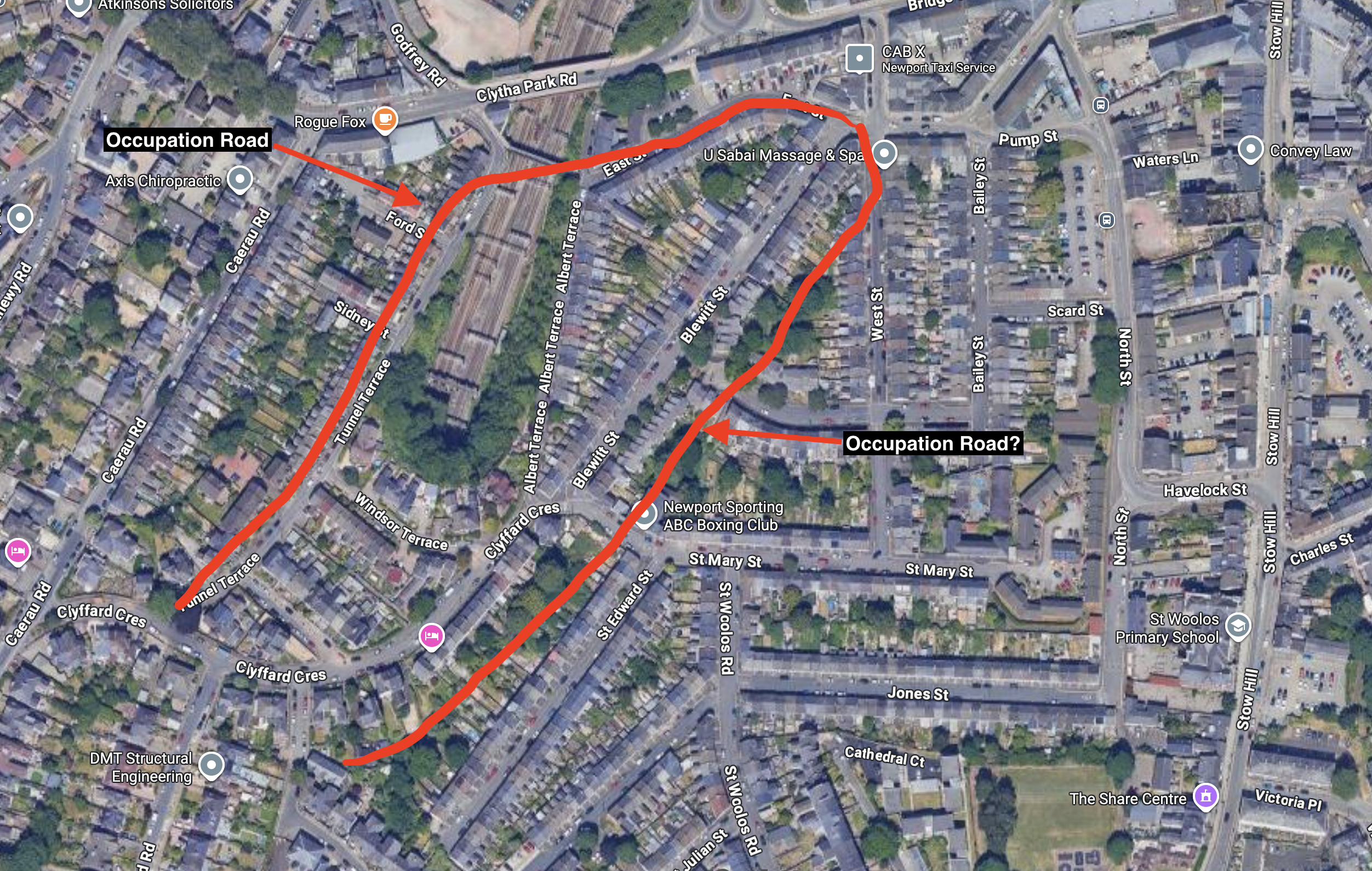
The track itself predated even the tithe map: an Ordnance Survey sheet, surveyed in 1811 and published around 1833, shows faint double lines tracing the identical alignment.
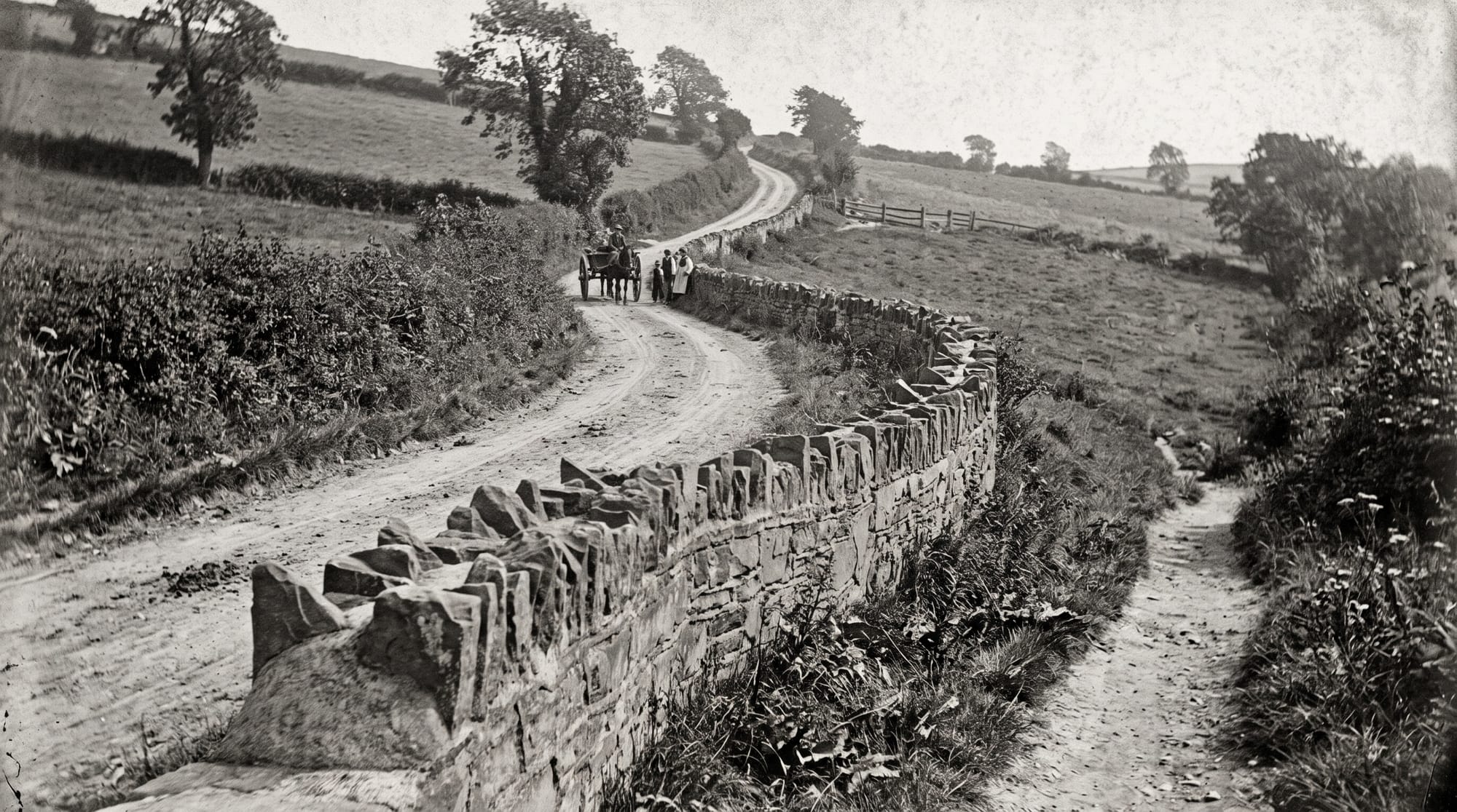
So, is the wall an original survivor? Given its exact alignment with parcel 279a on the tithe survey and its rustic vernacular masonry, it almost certainly began life as the revetment to that 1840 country lane. As Victorian terraced housing crept up the hillside, highway builders simply macadamised the old cart track above, leaving the sturdy stone revetment intact rather than risking the collapse of the new street. Structurally sound and perfectly placed, it remains a quiet agricultural fossil stranded in the middle of Baneswell.



Member discussion